Restoring Rangelands Without Reopening Old Disputes: Evidence from 13 Villages in Central Somalia
In central Somalia, degraded rangeland and contested grazing land are the same problem seen from two angles. A recently completed feasibility study and conflict analysis across 13 villages in Galmudug and Hirshabelle shows how spatial evidence and community consultation together produce restoration plans that communities will actually accept.
In the drylands of central Somalia, the condition of a grazing area and the state of relations between the communities who use it are rarely separate questions. Years of overgrazing, charcoal cutting and recurrent drought have thinned vegetation cover and pushed herders further in search of pasture and water, bringing groups into contact at exactly the moments when resources are scarcest. Restoration work planned on ecological merit alone can therefore fail for reasons that have nothing to do with ecology.
A recently completed assignment set out to address both dimensions at once, across 13 villages in four districts: Galkacyo, Dhusamareeb and Abudwak in Galmudug State, and Feerfeer village in Beletweyn District, Hirshabelle State. These communities range from arid pastoral settlements to agro-pastoral villages close to seasonal streambeds, and they sit along the interface of different ecological zones and different clan territories. Our technical team contributed to the two linked components of the work: a conflict analysis of resource-related disputes, and a feasibility assessment of the restoration and livelihood measures under consideration.
Reading the landscape from above and from the ground
The analysis combined three streams of evidence that were deliberately kept in tension with one another, so that each could check the others.
Satellite and terrain analysis supplied the landscape picture. Land cover was classified from 10 metre ESA WorldCover data, distinguishing grazing land, shrubland, woodland, cultivated areas and bare ground. An NDVI time series running from 2004 to 2024 identified where vegetation productivity had been declining rather than simply fluctuating with the seasons, and a historical land cover comparison covering 1990 to 2020 showed progressive loss of vegetation and expansion of bare land, most visibly around Galkacyo and Beletweyn. Elevation data were used to derive drainage networks, slope and surface water flow. Soil loss was modelled with the Revised Universal Soil Loss Equation, using a full calendar year of CHIRPS rainfall to calculate rainfall erosivity and an annual Sentinel-2 NDVI composite for the cover factor. Processing ran in Google Earth Engine and standard GIS software.
What made that modelling useful rather than decorative was that its limits were stated. The equation estimates sheet and rill erosion, so gully and riverbank erosion observed in the field were reported separately and qualitatively, and the outputs were read as relative erosion potential for planning rather than as measured sediment yield. Erosion hotspots emerged in southern Galkacyo, eastern Beletweyn and along roadside areas near Abudwak and Dhusamareeb.
Field consultation supplied what imagery cannot see. Twenty key informant interviews were conducted with elders, local authorities, community leaders and recognised peace actors, alongside five focus group discussions bringing together pastoralists, agro-pastoralists, women and youth from villages in each district cluster. Participatory mapping exercises were embedded in those sessions, with community members describing grazing areas, water points, migration routes and the places where tension recurs. More than 90 per cent of the intervention landscape turned out to be shrubland and grassland, which confirmed what the consultations were saying about livelihoods and pointed the intervention mix firmly towards rangeland rather than cropland measures.
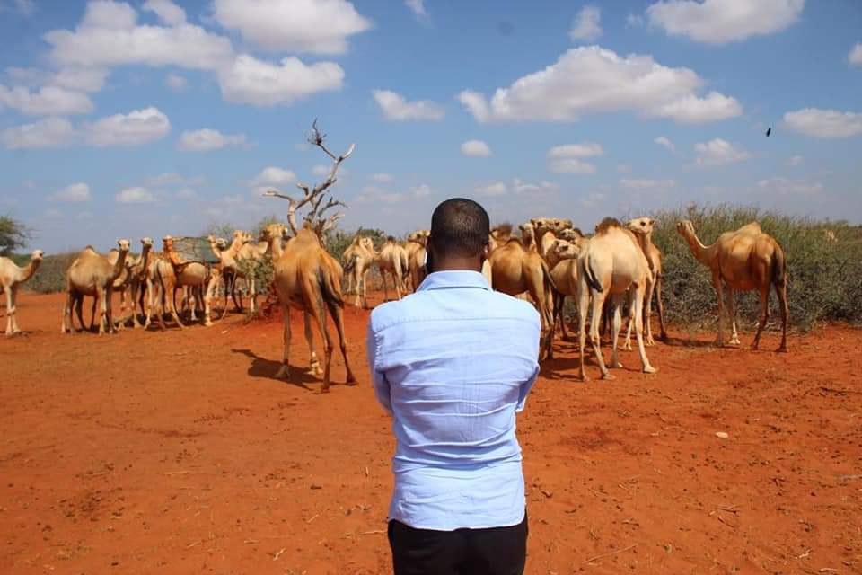
Grazing suitability was assessed separately for camel, cattle, goats and sheep, because a measure that suits a camel-herding system is not necessarily right for a village whose wealth is in sheep. Cattle suitability was highest around Beletweyn, camel grazing favoured the shrub-dominated areas of Galkacyo and Dhusamareeb, and sheep and goat suitability was widespread across Dhusamareeb and Abudwak.
Turning spatial evidence into siting rules
The conflict analysis was built around a conflict mapping framework supported by actor and driver analysis, and its most practical product was a set of spatial rules. Village positions and candidate intervention sites were overlaid with clan boundary information, livestock movement corridors, shared water points and locations of past disputes. A five kilometre buffer from known inter-clan boundaries was applied as an exclusion criterion for sensitive fixed infrastructure such as boreholes or fenced enclosures, and a one kilometre buffer was observed around shared water and grazing resources. Livestock trade routes were examined so that nothing would be sited in a seasonal migration bottleneck.
Villages were then classified on a two-tier scale of conflict sensitivity in relation to specific proposed measures, rather than in the abstract. Eleven of the 13 villages were assessed as low sensitivity, reflecting stable internal dynamics and clear local authority over the sites in question. Two villages, both close to inter-clan boundary zones, were classified as moderate and were given deliberately non-intrusive packages: household-level energy measures and tree planting well inside community land, with no fencing and no new shared infrastructure requiring negotiation between groups.
Each candidate measure was then scored against a multi-criteria framework covering technical feasibility, local availability of inputs, cost-effectiveness, environmental and social risk, conflict sensitivity, gender and inclusion, community demand, institutional capacity, maintenance burden, climate resilience and the time required to show results. Scores drew on field observation, cost information and community rankings, and the shortlist was validated with community leaders before being finalised.
What the communities ended up with
The result was a tailored package per village rather than a uniform menu. Pasture resting through community-agreed seasonal closure and assisted natural regeneration were prioritised where degraded rangeland could recover under customary management. Afforestation on designated communal land and efficient cookstoves were selected where charcoal pressure and woody biomass loss were the binding problems. A fodder bank was included in one village where leaders pressed for dry-season feed storage, and a livestock watering point was proposed in Feerfeer, where runoff convergence made the terrain suitable and where drawing animals away from cultivated field edges also reduced the risk of friction between herders and farmers. Villages whose catchment conditions could not support water infrastructure were excluded from it, which is a finding as valuable as a recommendation.
The deliverables included a village-level conflict profile map, an annex of eleven thematic maps covering grazing suitability by species, surface water and elevation, drought and flood exposure, land cover and modelled soil loss, and recommendations that treat conflict sensitivity as part of technical design rather than as a separate safeguard step.
What this demonstrates about SoMAP
This assignment sits at the centre of what our practice is built for: turning satellite data, terrain models, field observation and community knowledge into decisions that hold up both technically and socially. The harder capability on display is judgement, which means knowing which measure belongs where, which site to rule out, and when to say that the analysis cannot settle a question.
Comments (0)
No comments yet. Be the first to comment.